Kraków 2010-06-14
Tu-154 nb 101 crash with President Lech Kaczyński on board on April 10, 2010.
Part 3
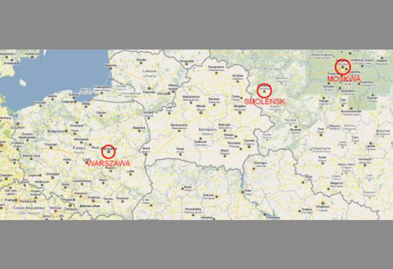
Airport Smoleńsk
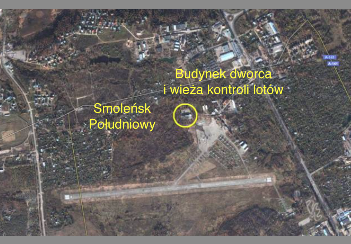
Smolensk-South airport.
There are two airports in Smolensk. One located south of the city center. They can be described as civil, sport or sanitary airports. It is an airport with poor infrastructure. It was used by small planes. RWY is 1 600 m long. Concrete pavement. Shortly after the catastrophe (on April 10, 2010), many journalists suspected that the accident had just happened at this airport, suggesting its civilian character.
As you can see, after the station building together with the flight control tower, Smolensk-South Airport aspired to the rank of modern airports. It was from this airport that Aerofłot maintained permanent and temporary connections with Moscow, Brańsk, Pskov and other cities on the CCCP, and then Russia and the CIS. Mainly An-2 aircraft were used. An-24, Yak-40 and Czechoslovakian L-410 also appeared. But due to unprofitability of connections, the Smolensk branch of Aeroflot was first dissolved, and then all flights were suspended (1991). Currently (2010) the airport is closed and there is no possibility for planes to land there and take off.
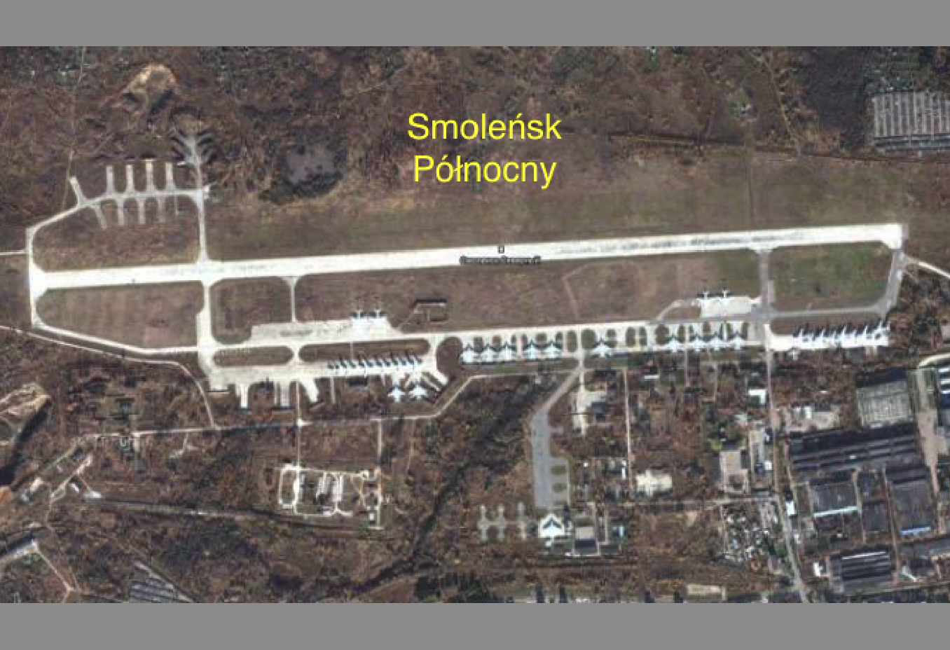
Smolensk-Severnyny airport.
Smolensk-Siewiernyj airport is the basic airport in Smolensk. Original name Смоленск-Северный, meaning Smolensk – North. It is located north of the city center and the railway station at a distance of 3 km.
This airport was established at the beginning of the 1920s. It was officially opened on May 1, 1922. This date is a feast of the proletariat. The first flight was made on 3 May 1922. The aircraft made a flight on the route Moscow-Smolensk-Kaunas (Kaunas) -Konigsberg.
The airport was used as a stage airport to refuel and exchange mail. Passengers flew less often. One of the first passengers was the poet Sergei Yesenin with his wife Isadora Duncan, who flew on 10.05.1922. In 1923 and 1925, the poet Włodzimierz Majakowski flew through Smolensk. Passenger flights ended in 1941. It was the year when the Soviet-German war began. During World War II, the airport was first used by the Germans, and after the Soviet front passed. From that moment, the airport was used almost exclusively by Soviet combat and transport regiments. Smolensk Factory Aviation (LMS) was launched next to the airport. The plant produced various aviation components and engines. Renovations were also made. Therefore, at the airport there was a military group performing flight tests. Also for civil aircraft. This plant has been functioning until now.
From the battle regiments, during the Cold War in 1951-1991, hunting and assault regiments were based here. Among them, 401, 412 and 871 PLM. Mainly various types of MiG aircraft were used here. In the 70s, MiG-23 aircraft appeared, and slightly later, Su-24 and Su-27 aircraft.
Transport regiments were also based in Smolensk. From 1946, there was 103 Gwardjan Krasnosielski Regiment of Transport Aviation named after The Hero of the Soviet Union W. S. Grizodubowa (Russian). The regiment was equipped with An-12, An-22, Il-76 aircraft, and recently Il-76 M / MD.
At Smolensk Airport, civilian traffic was minimal. Several times a year aircraft arriving from Moscow, with officials and delegations. Airport traffic has been systematically decreasing since the breakup of CCCP.
In autumn 2009, officially all airport-based military units were disbanded, although 103 PLTr officially moved to Orenburg. Several dozen planes remained at the airport. Looking at the number of aircraft it is the time of two regiments. They do not give the impression of preserved machines, only permanently operated. If they were not used, they would be at least partly covered with tarpaulins (engines, wheels, antennas, windows), and above all they would stand in the centrifugal zone in the northwestern part of the airport, and not the main PPS.
In October 2009, a branch of military headquarters No. 216 was established. At the beginning of 2010, the airport was probably entered in the register of civil airports. But in the world inventory of about 1,000 airports, Smolensk to date (2010) is not there.
The airport allows landing and take-off of aircraft class A, В, С, D, with restrictions related to the surface of the airport (according to the Pavement Classification Number). The airport is approved for aircraft weighing over 75,000 kg. In the southeastern part of the airport there are workshops of the Smolensk Aircraft Factory SmAZ (Russian Смоленский авиационный завод), belonging to the Yakovlev campaign.
Airport infrastructure.
The infrastructure of the facility is typical for a military airport from the 50s. The RWY runway measures 2,500 mx 49 m and is located in the E-W direction (26/08). RWY was initially with a ground surface and a length of about 1,500 m. In the 60s, the runway received a concrete surface and a length of about 2,000 m. In the 70s, the runway was given its current form. Currently (2010) the surface needs renovation.
The RWY is supplemented by an emergency runway located in parallel on the north side. It has dimensions of 2 100 mx 150 m. Its surface is soil (grass).
To this we have to add about 3,500 m DK, three PPS and about 40 individual stands of various sizes (for transport and fighter aircraft). The flight control tower is small and destroyed.
At the airport there are a lot of barracks serving warehouse and social and living functions. A lot of buildings are in the part occupied by the factory. The airport has a large base of fuels and lubricants. The tanks are numerous, but with a small capacity. There is also a large bomb-squad. There are also numerous railway sidings at the airport.
The airport is not completely fenced. Therefore, it is difficult to determine its actual surface. According to estimates, the airport has no less than 600 hectares, but it may well have an area and 2000 hectares.
Just behind the main gate of the airport, located on the southern side, the city of Smolensk begins. There are single-family houses in the city. There is also an officer housing estate with numerous apartment blocks. High and lower. The buildings are chaotic.
Approach to landing at the airport.
Please look at the picture above. This is the original Smolensk airport data page. It shows that the approach on direction 08 has a much better developed system of lights on the approach than on directions 26. Skora yes, the direction of the approach from the west is better. Many boarders, especially from the free world, immediately noticed that they were sitting in Smolensk from the west.
The layout of the terrain is also more favorable, more even, and thus a precise measurement of the flight height is much more reliable. East winds are more frequent in this region of Europe. There are no tall buildings from the west either. RWY skew also prefers west.
Eastern approach, direction 26, although due to the terrain is more difficult. The main reason for the difficulty in landing is the valley (gorge) at a width of about 1 500 m and a depth of up to 57 m. To the inconvenience of the eastern approach, one should add the vicinity of tall buildings and irregular (uncontrolled) trees. There are numerous self-sown trees and clumps of bushes.
For unknown reasons, on April 10, 2010, the Tu-154 M nb 101 aircraft were ordered to land from the east (26).
Smolensk North airport equipment.
The airport has modest equipment with means of communication and radiolocation. The airport’s navigation and communication equipment is at the technical level of the 1970s.
The airport does not have basic ILS equipment, which the Tu-154 M nb 101 was equipped with. This system is already standard at airports where large passenger planes land. It determines the landing glide path and allows you to safely bring the aircraft back when the pilot cannot see RWY. Depending on the ILS system class, it leads the aircraft even to the landing gear wheels coming into contact with RWY.
This does not mean, however, that you cannot land safely at the airport. There is an RSL system (blind landing system). He gives the pilot information about the height of the airplane and the distance from the runway. The RSL system or USL (blind landing devices) are mounted on both the west and east side of the DS. Presumably the western part was devastated. The system consists of two omnidirectional beacons called NBD (Non-Directional Beacon) in the west, both positioned exactly on the DS axis. Further (DRP – further beacon guiding) at a distance of 4000 m from the threshold. In Smolensk an unusual 6 100 m. At this point, the aircraft should have a height of 300 m. The crew of the Tu-154 M nb 101 aircraft knew this.
Closer BRP – a closer guide beacon, 1,000 m from the threshold. In Smolensk 1,100 m. At this point, the aircraft should have a height of 70 m. The beacons also have a radio-marker transmitter, which allows you to determine the flight over them and automatically switch the radio compass from indicating the direction to the beacon further to indicate the direction to the beacon closer.
In addition, in such a system there is also a KNS light signaling device, i.e. a large red flashing walrus code, positioned right next to the BRP (closer to the beacon guiding). It sends out light signals with a Morse coded letter, just like the proximal guide beacon.
The radar station, called the precision approach radar, complements this system. (PAR – Precision Approach Radar). This station is an example of three-coordinate radar. The approach system consisting of circular observation radar and precision radar is called the GCA system (Ground Controlled Approach) and is used until now (2010) where ILS has not developed.
The Soviets have intensively developed a whole series of precision approach stations, labeled RSP. At least RSP-6 or RSP-7 should be in Smolensk, although the latest ones are already in use RSP-10. The precision radar has two antennas: a facade antenna and a direction antenna. The elevation antenna makes vertical movements and is used to monitor the landing angle of the landing plane, while the direction antenna searches the sector about 15 degrees. The third antenna, the largest is a circular observation radar. Such radar is usually placed in the middle of the airport. Its rotating turret is set to the currently used landing direction. The PAR system is usually wheeled and often self-propelled (automotive).
The RSL system is a help system with which you can lead a plane to commands from the ground in TWA very precisely. It is important that both the crew and the controller work closely together. Even at visibility of around 500 m, the machine can be planted securely.
Undoubtedly, the distribution of beacons at the airport is not standard. Pilots admit that this arrangement is extremely rare. The crew of Tu-154 M nb 101 knew this.
We know that the approach from the west is also equipped with height control devices, the so-called outer marker and middle marker. That is the external and internal measuring point of the actual height of the flying aircraft. Using light and sound signals, he informs the crew of the correct height. If the altitude above the middle marker is incorrect, the landing is interrupted and the plane goes to the next circle.
But the condition of the equipment at the airport leaves much to be desired. We know that one of the beacons interrupted or did not work at all. What was the state of the radar’s precise approach is also unknown.
Approach lighting and RWY.
In addition to the RSL system, approach lighting and RWY itself are also important when landing in TWA. Original materials show that the lighting system on the west approach is more developed. From the east it is modest. The system of this lighting is typical for the Soviet airports of the 70s.
Approach landing lights are spaced approximately 1,500 m in both east and west. So the crew will spot the light much sooner than the RWY threshold notices. Approach lighting at every communication or military airport is standard. It is not expected that these systems will be abolished in the coming years. On the contrary. They are constantly being developed and modernized. They send a continuous beam of light or flash. Sometimes their color indicates to the crew whether they are at the correct height. They are also mounted on the surface on which planes taxi.
This lighting in Smolensk would not be so bad were it not for its condition. The approach lights from the east are a tragedy. They were placed on barked poles, a decaying shed, and finally directly on the trees. The design of the lamp itself is also unique in the world. It looks like a plastic, yellow pot with a diameter of only 30 centimeters, without a mirror reflector and protective glass.
Written by Karol Placha Hetman


