Siemirowice 2021-01-09
Infrastruktura Lotniska Siemirowice.
Współrzędne geograficzne: 54.416N 17.765E. Elewacja 151 m (505 ft).
Przez ponad 50 lat infrastruktura Lotniska Siemirowice się zmieniała. Dostosowywaną ją do używanego tutaj sprzętu latającego. Ostatnie lata przyniosły kolejne zmiany, co do roli jaką ma pełnić Polskie Lotnictwo Morskie. Nowe zadania (już nie typowo bojowe), ale równie ważne dla Rzeczypospolitej Polskiej i Morza Bałtyckiego postawiły nowe zadania, które z powodzeniem wykonują lotnicy z Siemirowic. Lotnicy Morscy dysponują już sprzętem latającym na świtowym poziomie, a i infrastruktura nadąża za nowym sprzętem.
W 2010 roku, przystąpiono do realizacji tematów związanych z bezpieczeństwem Lotniska Siemirowice. Wśród nich znalazły się; wykonanie systemów sygnalizacji włamania i napadu (SSWiN), wykonanie telewizji przemysłowej (CCTV), wykonanie systemu kontroli dostępu (SKD), modernizacja systemu przeciwpożarowego. Wszystko to w obiektach; JW. 4653 Siemirowice (razem z Klubem Garnizonowym), Komenda Lotniska Nr 2 Darłowo (także razem z Klubem Garnizonowym), JW. 4650 Siemirowice, JW. 4649 Darłowo, Centrum Wsparcia Teleinformatycznego i Dowodzenia MW Siemirowice i Darłowo. Na Lotnisku Siemirowice remontowi został poddany MPS Nr 2. Lotnisko Siemirowice otrzymało nowe ogrodzenie i bramy wjazdowe.
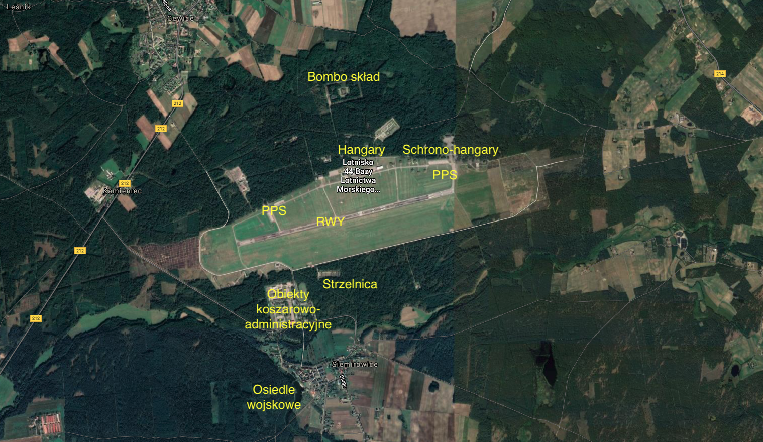
RWY.
Lotnisko Siemirowice posiada jedną drogę startową (RWY). RWY o wymiarach 2 500 m x 60 m, leży na kierunku 07/25. Powierzchnia 150 000 m kwadratowych. Nawierzchnia asfalto-betonowa. RWY była w stanie przyjąć każdy eksploatowany w Polsce statek powietrzny. Początkowo RWY miała długość 2 000 m i tylko raz została przedłużona o 500 m po stronie zachodniej. RWY była remontowana co 5-7 lat. Po ostatnim remoncie została eksploatacyjne skrócona i jest wykorzystywana w części wschodniej. Wynikło to braku konieczności dysponowania tak długą drogą startową. Równolegle do RWY, z południowej strony, wytyczono awaryjną RWY, o nawierzchni gruntowej (trawa).
Drogi kołowania, płaszczyzny postoju samolotów i hangary.
Niemal równolegle do RWY, po stronie północnej, poprowadzono główną drogę kołowania o długości około 3 000 m. Łączy się ona z RWY pięcioma łącznikami o długościach od 180 m do 280 m. Łącznie Lotnisko dysponuje około 5 250 m drogami kołowania. Lotnisko posiada pięć PPS. CPPS ma wymiary 400 m x 90 m i powierzchnię 36 000 m kwadratowych. To na niej na przełomie wieków postawiono 6 lekkich metalowych hangarów, przeznaczonych dla samolotów M-28 Bryza. Pozostałe 4 PPS ulokowano z jednego i drugiego krańca głównej DK. Każda z nich ma powierzchnię około 16 000 m kwadratowych. Łącznie płaszczyzny postoju samolotów mają powierzchnie ponad 100 000 m kwadratowych. Prawdopodobnie w 1958 roku, oddano do eksploatacji pierwszy istniejący do dnia dzisiejszego hangar. Posadowiono go na zachód od CPPS. Początkowo służył do remontów i przeglądów samolotów typu Ił-28. Do dnia dzisiejszego widnieje na nim znak służb technicznych. Hangar ma w podstawie wymiary 60 m x 40 m.
Inne obiekty.
Lotnisko dysponuje jedną z najlepiej rozwiniętych sieci rozśrodkowania maszyn bojowych. Usytuowanie Lotniska w lesie sprzyjało zachowaniu własnego bezpieczeństwa. Na początku istnienia Lotniska powstało 20 indywidualnych stojanek, o betonowych nawierzchniach. Z czasem budowano kolejne. Z końcem 60-tych lat, te które znajdowały się blisko pola wzlotów, zostały otoczone wałami ziemnymi. Na przełomie 70/80-tych lat wybudowano schronohangary. Obecnie na Lotnisku możemy wyróżnić cztery strefy rozśrodkowania stojanek dla samolotów i śmigłowców. Strefa centralna umieszczona wzdłuż głównej drogi kołowania dysponuje 25 stojankami. W części północno-wschodniej umieszczono 16 schrono-hangarów. W części południowo-wschodniej jest 19 stojanek, a w części północno-zachodniej 18 kolejnych. Ponieważ powstawały one w różnych okresach i dla różnych samolotów, różnią się wielkością i zastosowanymi rozwiązaniami.
Za CPPS znajduje się wieża kontroli lotów. Wieża kontroli lotów to typowy budynek z 60-lat. Takie same obiekty zbudowano na przykład w Balicach, Inowrocławiu i innych. Jest to pięciokondygnacyjny budynek. Lotnisko Siemirowice posiada pełne zaplecze bojowe, eksploatacyjne i szkoleniowe. Znajdują się tu; dwa składy MPS, bomboskład, strzelnica, bunkry i schrony, środki obrony przeciwlotniczej, zaplecze techniczne, niezbędne środki łączności, systemy lądowania i inne.
Podstawowe dane Lotniska Siemirowice.
Lotnisko Siemirowice zlokalizowane jest w Województwie Pomorskim, Powiecie Lęborskim, Gminie Cewice. Inne dopuszczalne nazwy; Lotnisko Cewice, Lotnisko Łebunia. Współrzędne geograficzne; 54,24,58 N, 17,45,48 E. Lotnisko leży na wysokości 151 m nad poziomem morza (505 ft). Kod Lotniska ICAO – EPCE.
Obszar Lotniska rozciąga się na długości blisko 6 500 m, a szerokość w najszerszym miejscu wynosi 1 500 m. Łączna powierzchnia to około 900 hektarów. Większość z nich to tereny zalesione. Samo pole wzlotów ma wymiary 3 400 m x 800 m.
Adres JW. 4653 ( 44 BlotM ) 44. Baza Lotnictwa Morskiego. Siemirowice 84-312 Cewice. tel. +48598614100, fax +48598614129, TWR tel.: +48598614030.
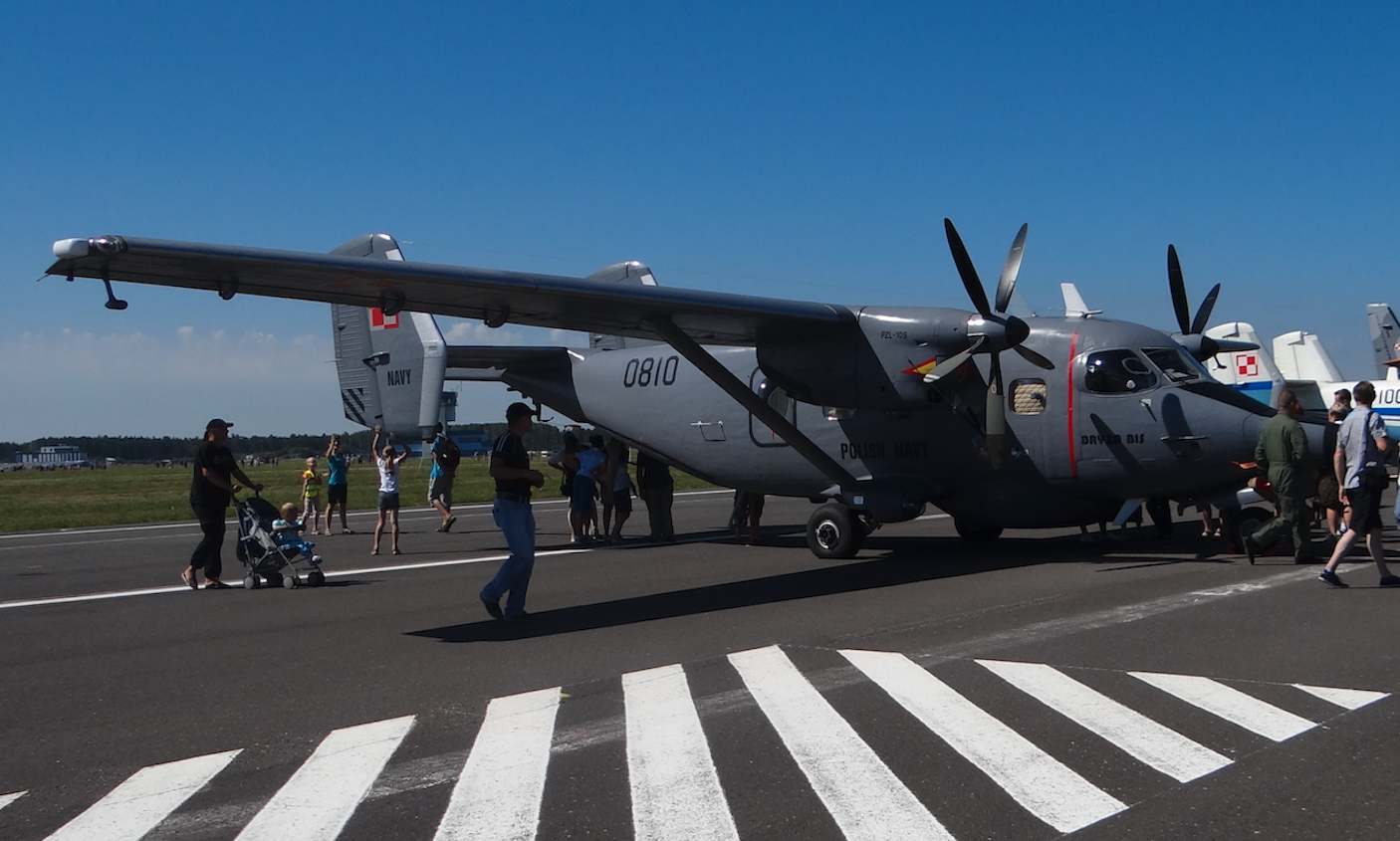
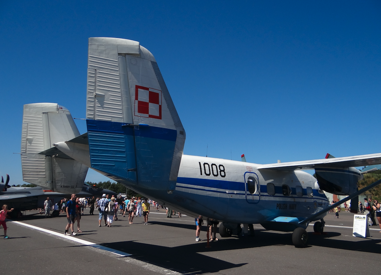
Na Lotnisku Siemirowice bazują samoloty: Samoloty patrolowo-rozpoznawcze M28B 1R (An-28B1R, BRYZA). Samolot patrolowo-rozpoznawczy M28B 1RM/BIS (BRYZA BIS). Samoloty monitoringu ekologicznego An-28 (An-28E). Z Lotniska Darłowo przylatują śmigłowce: Śmigłowce ratownicze PZL W-3WARM Anakonda. Śmigłowce ratownicze Mi-14PŁ/R. Śmigłowce ZOP Mi-14PŁ. Śmigłowce PZL Mi-2.
Opracował Karol Placha Hetman