Siemirowice 2021-01-09
Infrastructure of the Siemirowice Airport.
Geographic coordinates: 54.416N 17.766E. Elevation 151 m (505 ft).
For over 50 years, the infrastructure of Siemirowice Airport has changed. It is adapted to the flying equipment used here. Recent years have brought further changes in the role to be played by Polish Maritime Aviation. New tasks (not typically combat tasks anymore), but equally important for the Republic of Poland and the Baltic Sea, have set new tasks that are successfully performed by pilots from Siemirowice. Naval aviators already have world-class flying equipment, and the infrastructure keeps pace with the new equipment.
In 2010, topics related to the safety of Siemirowice Airport were implemented. Among them were; execution of burglary and assault signaling systems (SSWiN), execution of closed-circuit television (CCTV), execution of an access control system (SKD), modernization of the fire protection system. All of this in the facilities; JW. 4653 Siemirowice (together with the Garrison Club), Airport Headquarters No. 2 Darłowo (also together with the Garrison Club), Military Unit. 4650 Siemirowice, JW. 4649 Darłowo, Teleinformation Support and Command Center of MW Siemirowice and Darłowo. At Siemirowice Airport, MPS No. 2 was renovated. Siemirowice Airport received a new fence and entrance gates.
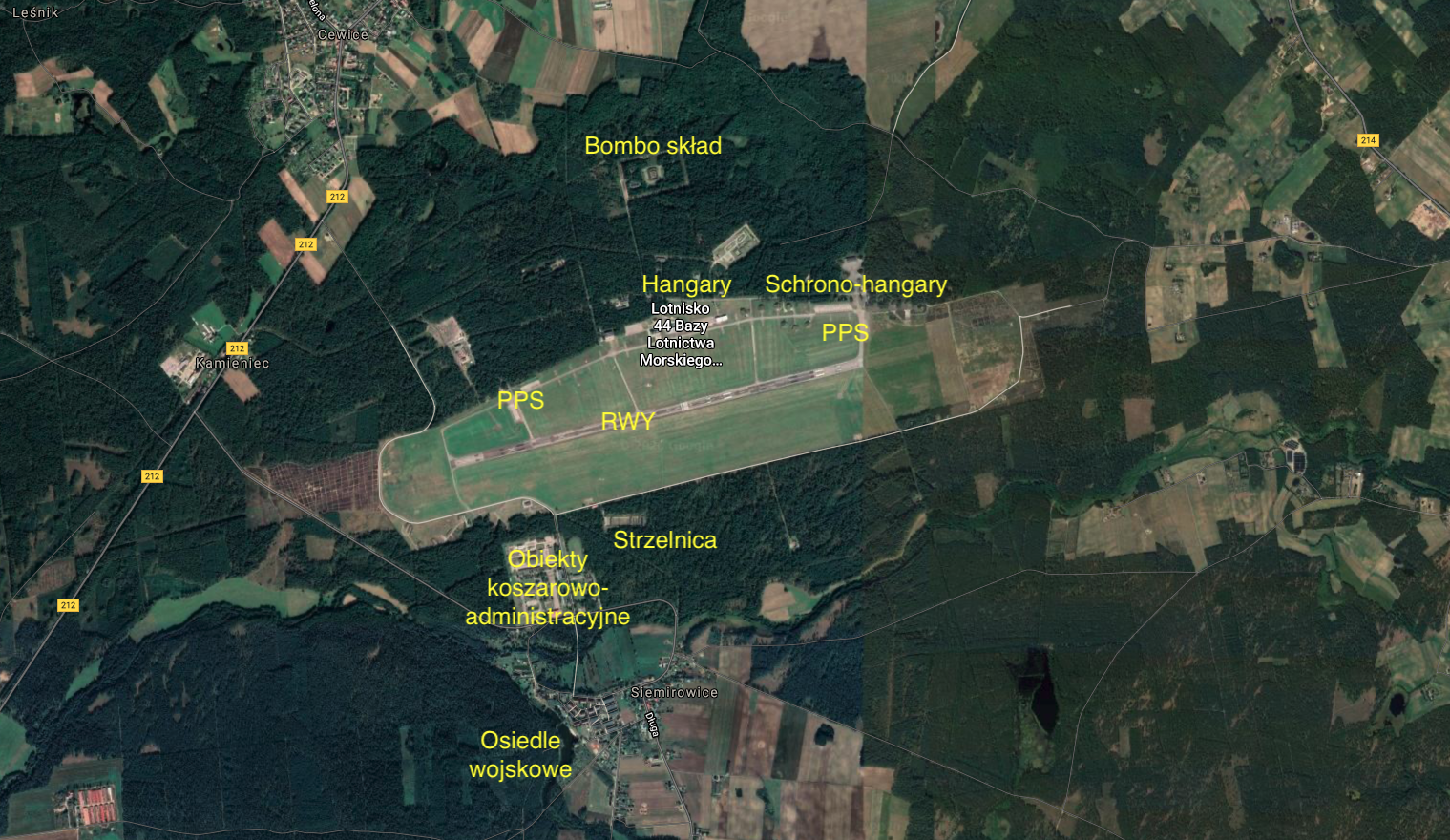
RWY.
Siemirowice airport has one runway (RWY). RWY with dimensions of 2 500 m x 60 m is located in the direction 07/25. Area 150,000 square meters. Asphalt-concrete surface. RWY was able to accept any aircraft operated in Poland. Initially, the RWY was 2,000 m long and was extended only once by 500 m on the west side. RWY has been renovated every 5-7 years. After the last renovation, the service life has been shortened and is used in the eastern part. This resulted from the lack of the need to have such a long runway. Parallel to the RWY, on the south side, there is an emergency RWY with a ground surface (grass). Taxiways, aircraft parking areas and hangars.
Almost parallel to RWY, on the northern side, there is a main taxiway, approximately 3,000 m long. It connects with the RWY by five links, 180 m to 280 m long. In total, the airport has approximately 5,250 m by taxiways. The airport has five PPS. The CPPS measures 400 mx 90 m and has an area of 36,000 square meters. It is here that at the turn of the century, 6 light metal hangars were erected, intended for the M-28 Bryza aircraft. The remaining 4 PPS were located from one and the other end of the main DK. Each of them has an area of approximately 16,000 square meters. In total, the aircraft parking planes have an area of over 100,000 square meters. Probably in 1958, the first hangar existing to this day was put into operation. It was located west of the CPPS. Initially, it was used for repairs and inspections of Ił-28 aircraft. To this day, it carries the mark of technical services. The hangar in the base measures 60 m x 40 m.
Other facilities.
The airport has one of the best developed networks for the centering of combat machines. The location of the airport in the forest was conducive to maintaining one’s own safety. At the beginning of the existence of the airport, 20 individual stands with concrete surfaces were built. More were built over time. At the end of the 1960s, those that were close to the landing area were surrounded by earth embankments. At the turn of the 1970s and 1980s, shelters were built. Currently, at the airport, we can distinguish four zones of centering the stator for airplanes and helicopters. The central zone, located along the main taxiway, has 25 stands. In the north-eastern part there are 16 shelter-hangars. There are 19 stands in the south-eastern part, and 18 more in the north-western part. As they were created at different times and for different aircraft, they differ in size and solutions used.
Behind the CPPS there is an air traffic control tower. The air traffic control tower is a typical 60-year-old building. The same facilities were built, for example, in Balice, Inowrocław and others. It is a five-story building. Siemirowice Airport has full combat, operational and training facilities. They are here; two MPS depots, bomb depot, shooting range, bunkers and shelters, anti-aircraft defense, technical facilities, necessary means of communication, landing systems and others.
Siemirowice Airport data.
Siemirowice airport is located in the Pomeranian Voivodeship, Lębork District, Cewice Commune. Other acceptable names; Cewice Airport, Łebunia Airport. Geographical coordinates; 54.24.58 N, 17.45.48 E. The airport is located 151 m above sea level. ICAO Aerodrome Code – EPCE.
The airport area is nearly 6,500 m long and 1,500 m wide at its widest point. The total area is approximately 900 hectares. Most of them are forested areas. The take-off area itself is 3,400 mx 800 m.
JW address. 4653 (44 BlotM) 44th Naval Aviation Base. Siemirowice 84-312 Cewice. tel. +48598614100, fax +48598614129, TWR tel .: +48598614030.
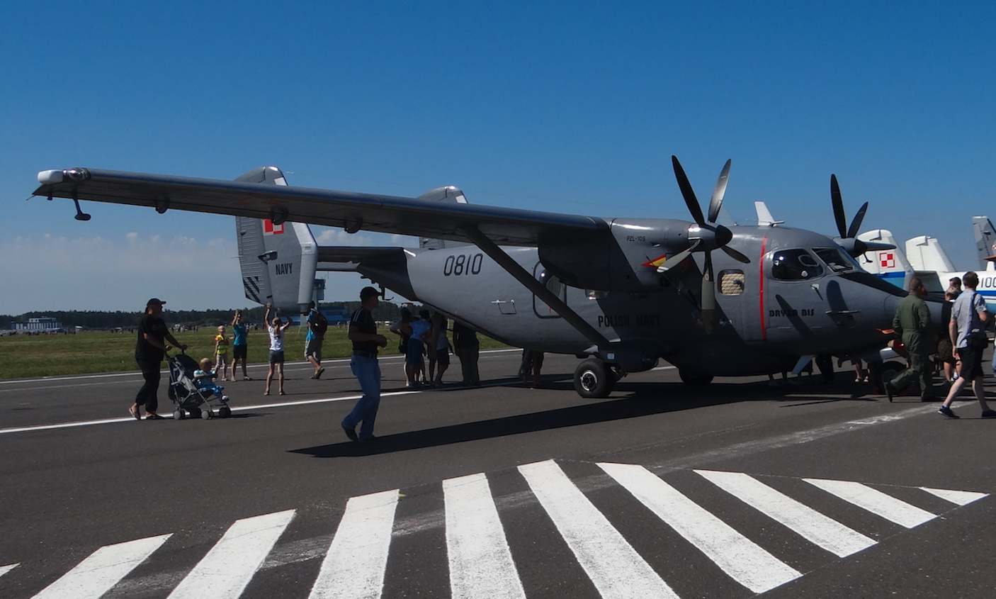
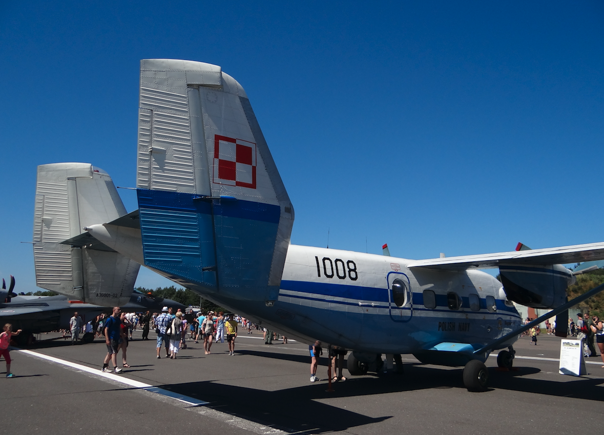
The following planes are based at Siemirowice Airport: Patrol and reconnaissance planes M28B 1R (An-28B1R, BRYZA). M28B 1RM / BIS patrol and reconnaissance aircraft (BRYZA BIS). An-28 (An-28E) ecological monitoring aircraft. The following helicopters arrive from Darłowo Airport: PZL W-3WARM Anakonda rescue helicopters. Rescue helicopters Mi-14PŁ / R. ZOP Mi-14PŁ helicopters. PZL Mi-2 helicopters.
Written by Karol Placha Hetman


