Jelenia Góra 2021-11-24
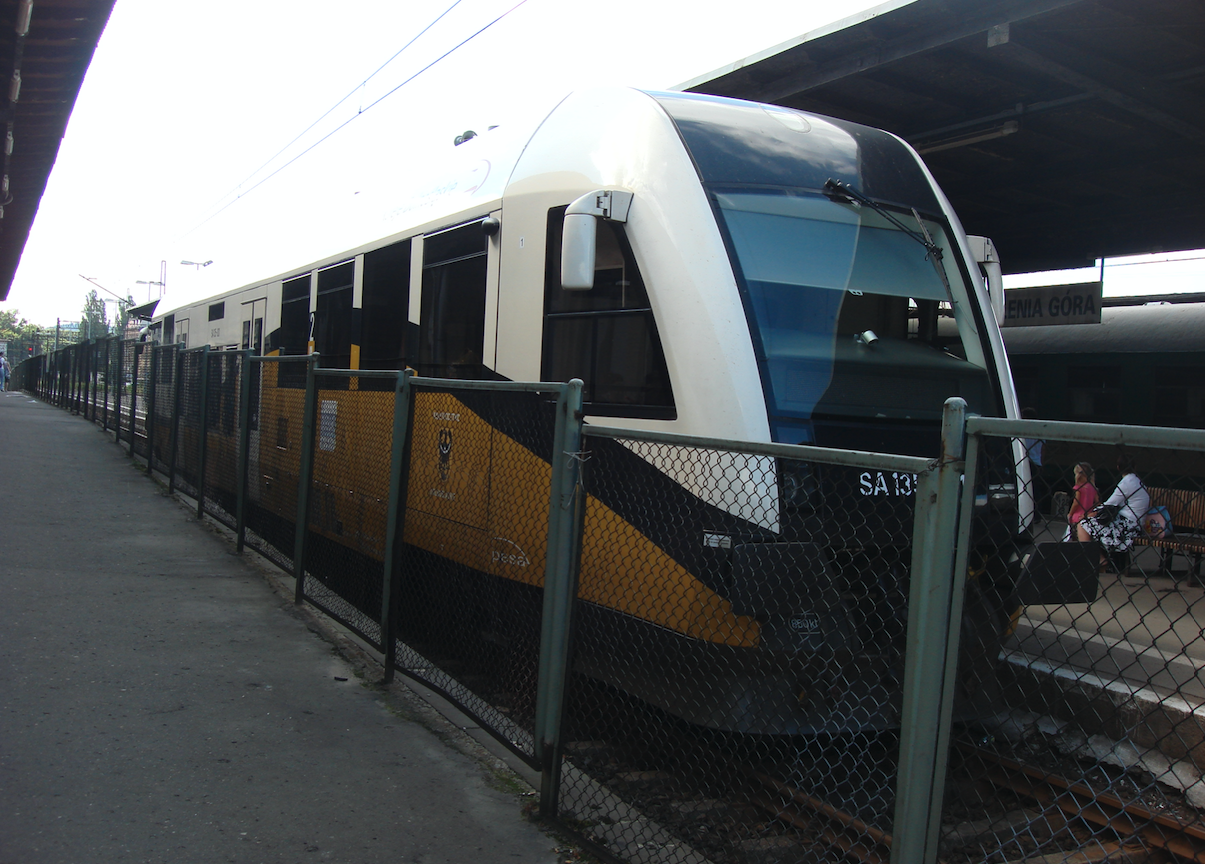
The passenger train Jelenia Góra - Lwówek Śląski. 2010 year.
The Bóbr Valley Railway.
In 2010, the SA135-001 PESA train served the Jelenia Góra - Lwówek Śląski route.
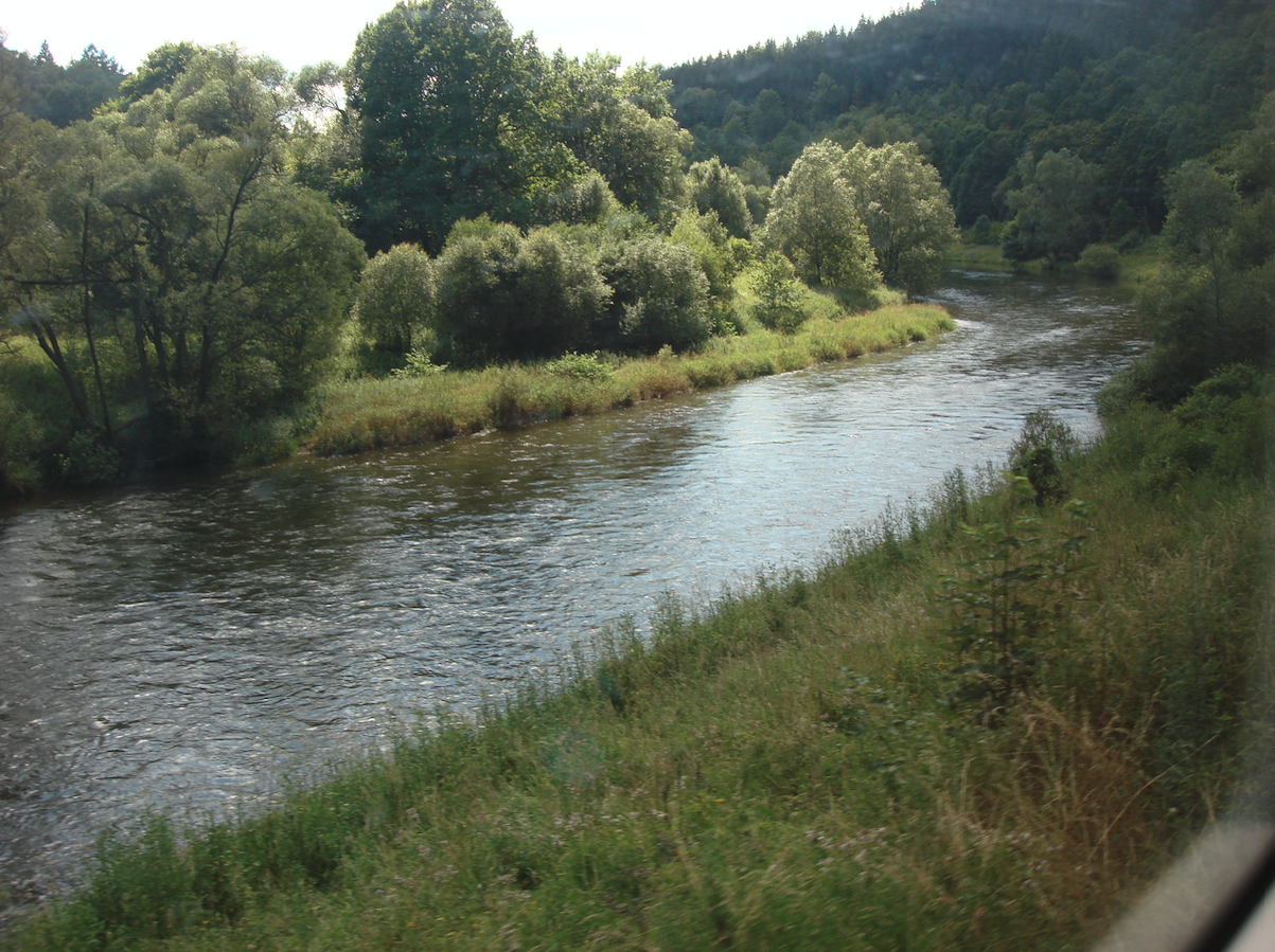
The Bóbr Valley Landscape Park is one of the most interesting places in the Sudetes in terms of nature and landscape. It covers almost 11,000 hectares between Jelenia Góra, Wleń and Lwówek Śląski. It is located in the Jelenia Góra Valley, the Kaczawskie Mountains and the Izera Foothills, which are very diverse in terms of relief and landscape. The main link of the landscape park is the Bóbr River, 272 km long, which is the left tributary of the Odra River. The Bóbr River has its source in the Czech Republic, but mostly flows through Poland.
The Jelenia Góra station was launched in 1866, while the Lwówek Śląski station was established in 1885. Both cities were connected by a direct railway route in the period 1905 - 1909, the length of which is 32.63 km. The route Jelenia Góra - Lwówek Śląski is technically difficult, has numerous bends and exits / climbs, and at the same time is very picturesque in terms of landscape. The route runs through three tunnels and crosses the Bóbr River several times. There are famous and beautiful bridges along the route. The maximum speed on the trail never exceeded 60 km / h. The trail is single-track and non-electrified. Currently (2021), there is no rail traffic there. The last passenger train traveled this route in 2016. The route belongs to the railway line No. 283 Jelenia Góra - Żagań, with a total length of 104 km.
There were several reasons for building the Bóbr valley railway. One of the most important was the construction of a dam in Pilchowice. At the end of the 19th century, the Giant Mountains were hit by a huge flood. Heavy rainfall, which took place on July 28-31, 1897, caused the flooding of the Bóbr River. Material losses were in the millions of marks. There were human casualties. The German government in Berlin decided to build a retention reservoir.
In connection with the construction of an artificial water reservoir, it was decided to build a railway line to facilitate the transport of building materials. Mainly materials from nearby quarries. After the construction was completed, the trail was still used for transport purposes. This line transported, among others, hard coal from mines near Wałbrzych. Both engineering structures (the dam and the railway) were built in the period 1902-1909.
Already in Poland, after the Second World War, rail traffic on the route No. 283 was heavy. Many passenger trains ran here from and to Jelenia Góra. In 40 years, the trains traveled as far as Zielona Góra and Poznań, and in 50 years the farthest, because to Szczecin. The situation began to change in the 1970s, because the Jelenia Główna - Lwówek Ślaski route was not electrified and steam and diesel locomotives ran on it. At the beginning of the 1990s, all further connections, for example to Żagań, were suspended. The situation improved when modern SZT, which belonged to Koleje Dolnośląskie, entered the trail. Unfortunately, for a short period of time, only until 2015.
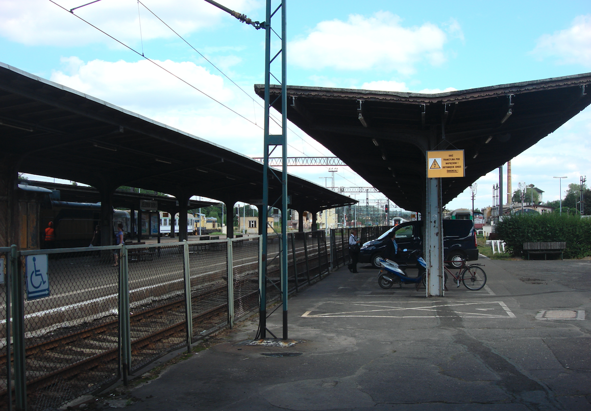
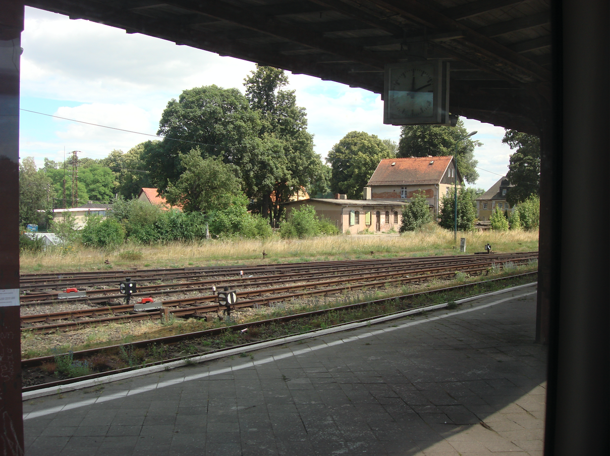
Jelenia Góra Railway Station.
The railway line No. 283 started at the Jelenia Góra station, which is located at 1 Maja and Krakowska streets. Jelenia Góra station was established in 1866, and currently has the rank of a regional station. It is a junction station because it combines as many as four railway routes No .: 274, 283, 308 and 311. The station has 4 platforms and tracks with electric traction. The underpass is open. The platforms were roofed in 1910. The Germans installed the electric traction in February 1923. It was a 15 kV / 16 2 / 3Hz network. It is worth remembering that in May 1945, after the entry of Russian troops, the German electric traction system was dismantled and taken to Moscow. It is not known when Jelenia Góra was electrified again, but with the Polish 3 kV network. Certainly, in 1987, the section Jelenia Góra (Dębowa Góra) - Szklarska Poręba Górna (PKP) was electrified.
Railway route No. 283.
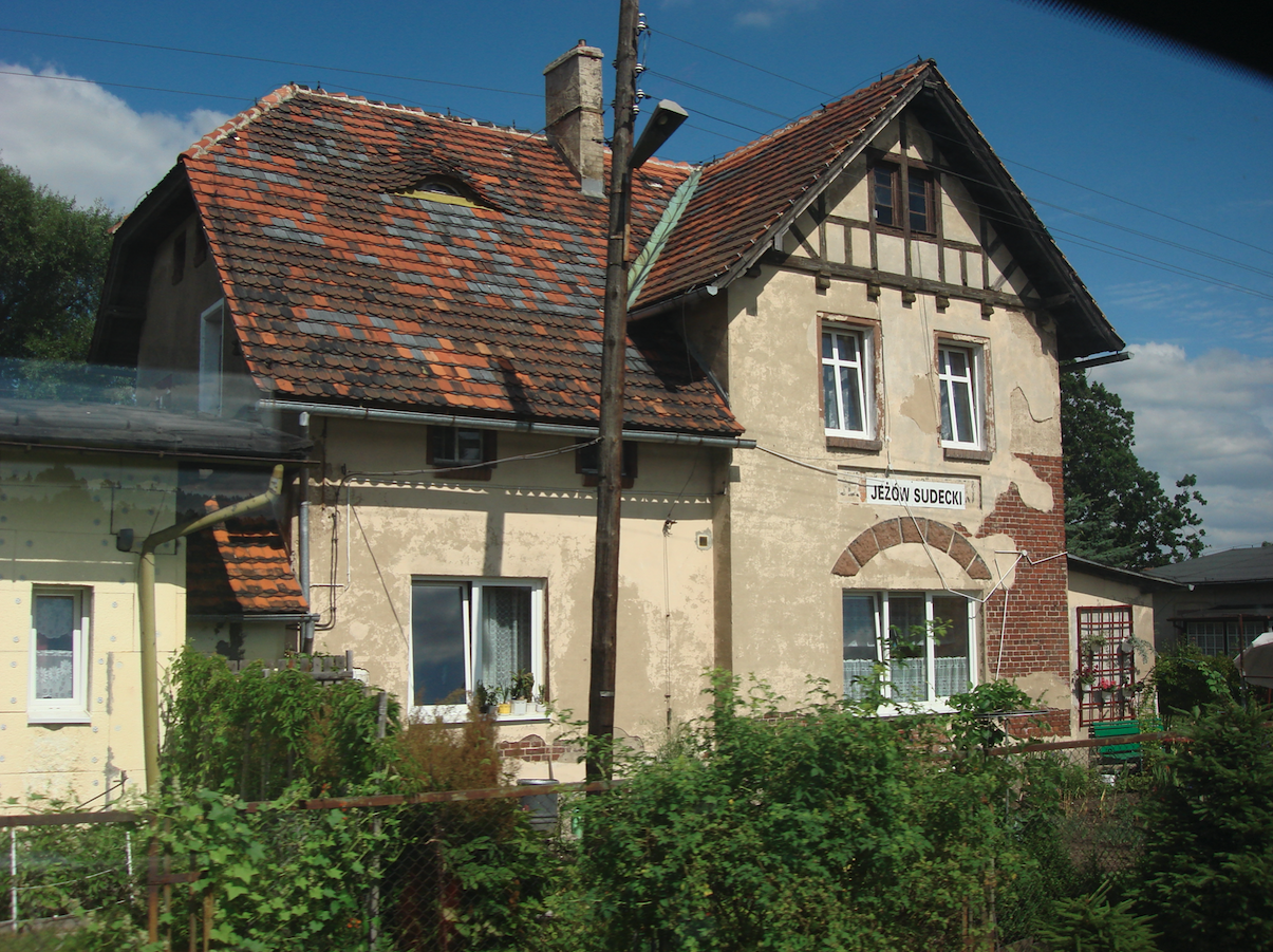
The railway line No. 283 runs from Jelenia Góra in the north-west direction, initially along with the lines No. 274 and 311. Within the city limits, the track crosses the Bóbr River for the first time. Here in 2019, a new train stop, Jelenia Góra Zabobrze, was built. Then, the trail runs under the viaduct of the National Road No. 3 and turns left to pass the right curve under the railway viaduct of routes No. 274 and 311, and then goes north, rising at the same time. The route passes agricultural land with large cultivated fields. Before Jeżów Sudecki (3,519 km), the route reaches the highest point of the entire line (343 m above sea level). Jeżów Sudecki was the initial railway station, and then only a railway stop. The station is now a residential house. The station was launched in 1909. Jeżów Sudecki is known from the glider factory and the glider airfield.
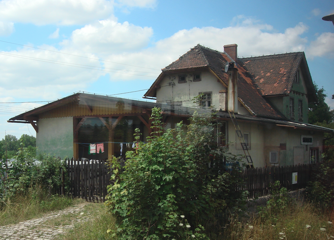
Next, the trail passes the village of Siedlęcin (7.321 km), where there used to be a railway station. Currently, the station is a residential building.
Further on, the trail starts twisting in a forested area and reaches Pilchowickie Lake. Here is a beautiful railway bridge, commissioned in 1904. The bridge rests on two stone and concrete pillars, 85 m apart. The abutments of the bridge were also built of stone and concrete. The main structure of the bridge rests on these pillars, ie a 135-meter-high, riveted steel structure, truss, 4 m wide. The bridge has steel railings, one track with fenders and wooden paths for servicing the structure. The total length of the bridge is 152 meters. The distance from the bridge to the water surface is 38 meters.
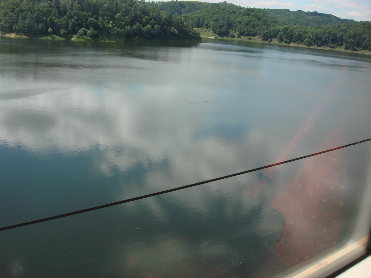
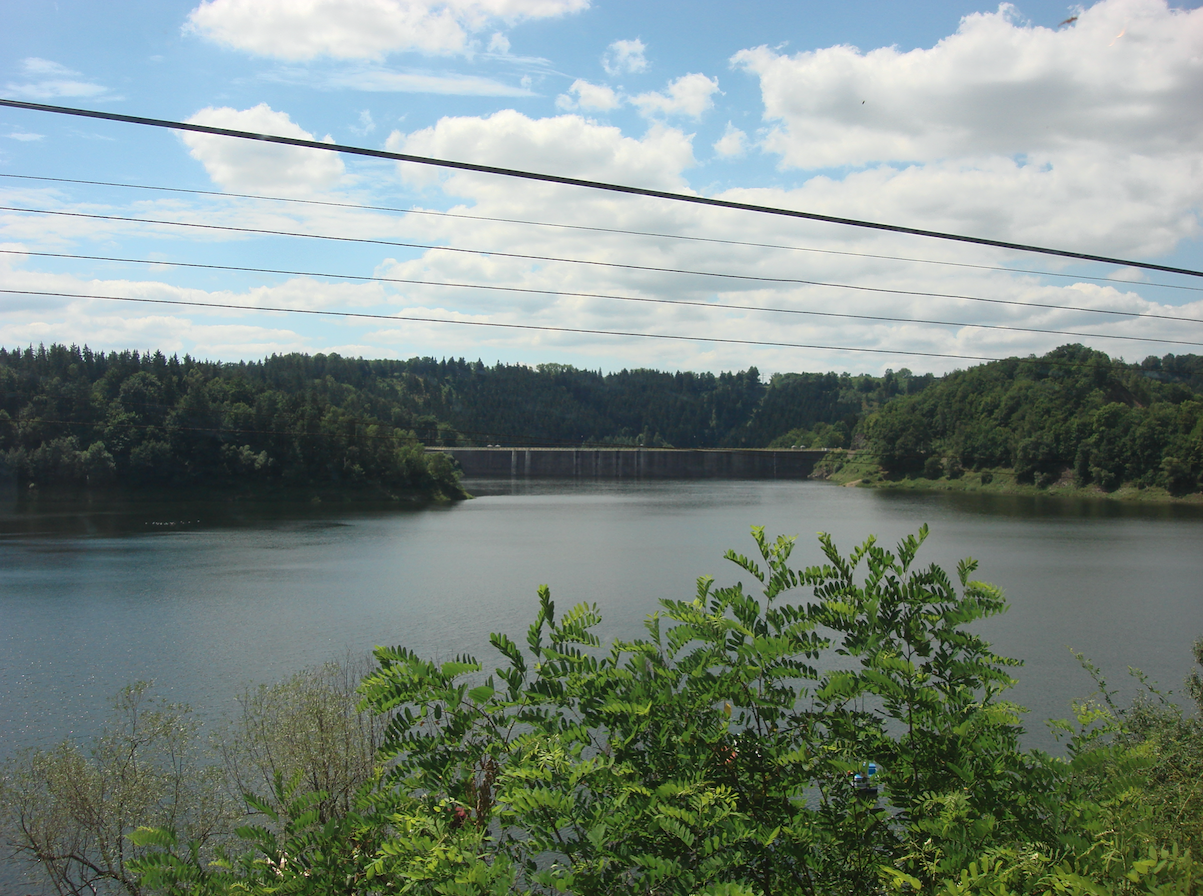
The Pilchowice Dam is the largest arch and stone dam in Poland. The second highest after Solina. The opening of the dam in 1906 resulted in the creation of Pilchowickie Lake on the Bóbr River. The lake is surrounded by dense forests and the terrain is varied, so it immediately became a great tourist attraction. There are numerous hiking and biking trails around. The lake is 4 km long and 300-400 meters wide, which is over 200 hectares. At its deepest point, right next to the dam, it reaches a depth of 46 meters.
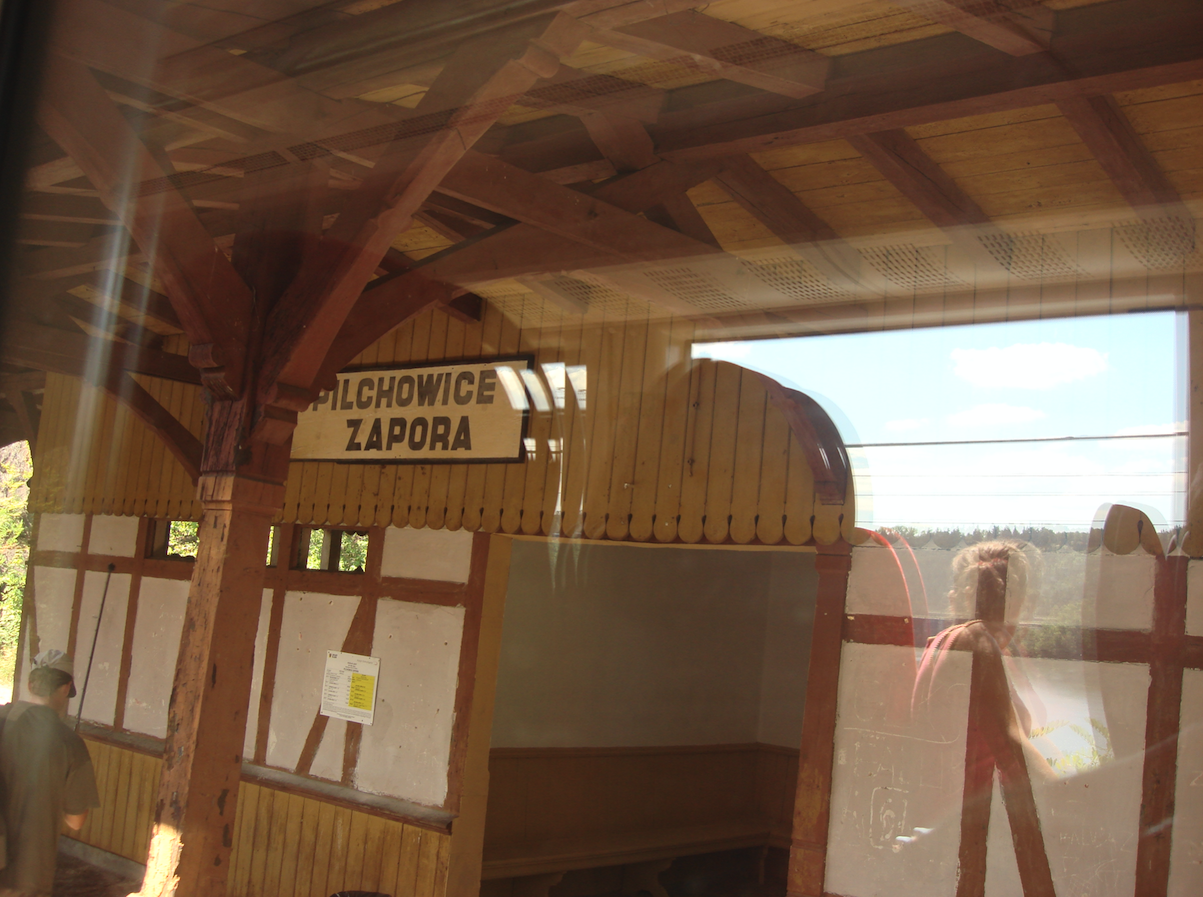
Next is the Pilchowice Zapora passenger stop. The stop has a single-edge platform. The stop is located at an altitude of 292 m above sea level and is at 11.16 km of the route. The difference in height between Jelenia Góra and the stop is 51 m, downhill. The stop is located on a steep slope on a special shelf. The stop has a covered platform and a waiting room. A paved path leads from the stop to the dam.
Now there are two tunnels on the route; Pilchowicki Tunnel I, Pilchowicki Tunnel II. The first tunnel, called Tunel Pilchowicki I, is 187.30 m long and covers 11.70 km of the route. The tunnel runs under the Czyżyk Mountain, which is 425 m above sea level. All the hills in the area are covered with mixed forest. The tunnels were built at the same time as the railway route and the Pilchowice dam, and were completed in 1907. The tunnel was built with hewn sandstone stone. Its structure is resistant to the pressure of the rock mass from the top and the side. It is 5.80 m high and 4.20 m wide and runs in a slight curve to the right. The tunnel is designed for one track. The tunnel was dug using the experience of tunneling in Austria. First, a smaller tunnel, called the directional tunnel, was dug to a depth of several meters. Then widening and deepening it, and lining it with sandstone. When building the tunnel, the spoil was transported using a narrow-gauge railway, using narrow-gauge tracks intertwined with tracks of normal width. One rail was common. When Stalin's illiterates entered the Sudetes in 1945, they tried to blow up the tunnels. According to other sources, it was done by German soldiers, a painter of Hitler. Tunnel portals damaged. But as early as 1946, the tunnels were passable. Tunnel inlets were repaired using reinforced concrete.
Further on, the trail meanders slightly downhill. There is a beautiful stone arch bridge (there are three arches) on the route, 19 m high and 50 m long. The track goes upwards, and the road to Jelenia Góra runs downwards. Next there is a tunnel called Tunel Pilchowicki II, which is 153.85 m long. It is at an altitude of 252 m above sea level and is on the route of 13.80 km. Next is another typical railway viaduct. The tracks pass overhead.
The Pilchowice Nielestno passenger stop is located at 14.81 km of the route. This stop was also a loading station. A warehouse, railway siding and unloading ramp have been preserved next to the station building. A hydroelectric power plant, which belongs to Zakład Energetyczny Jelenia Góra, is built next to the station on the water canal. The water canal is a bypass of the Bóbr River.
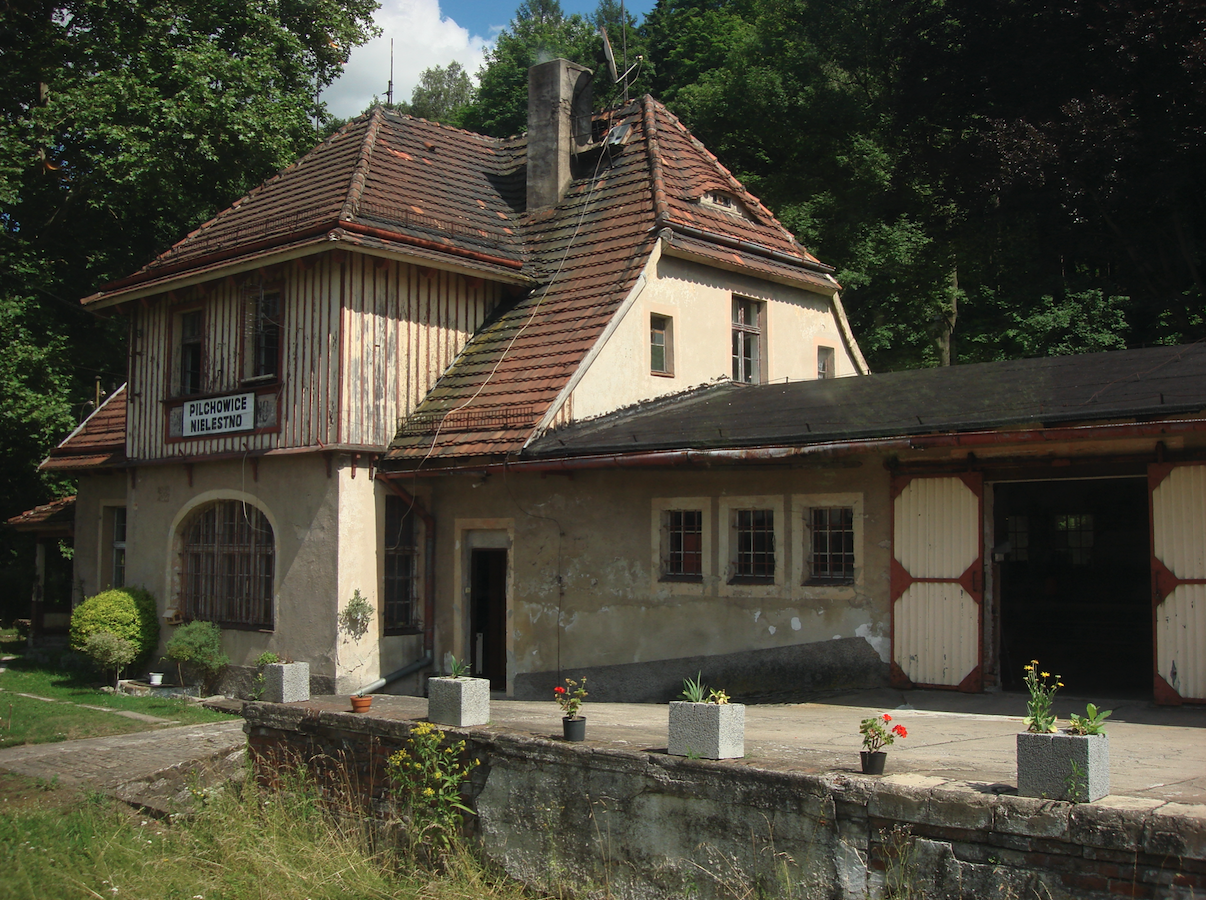
Next to the station on 14.94 km of the route, there is another nice railway bridge over the Bóbr River. The bridge is steel, riveted, and the tracks are laid at the bottom of the truss. The bridge is about 65 m long. Its abutments are made of stone.
The now defunct Pilchowice Nielestno Towarowe station is located at 15.55 km of the route. The former station is 235 m above sea level.
Further on, the trail (17.54 km) goes through the longest tunnel on the route under Góra Zamkowa, which is 360 m above sea level. This is the third tunnel. Interestingly, there is a cemetery on Góra Zamkowa. The tunnel is 320 m long and is 235 m above sea level. The tunnel is called Tunel Pilchowicki III.
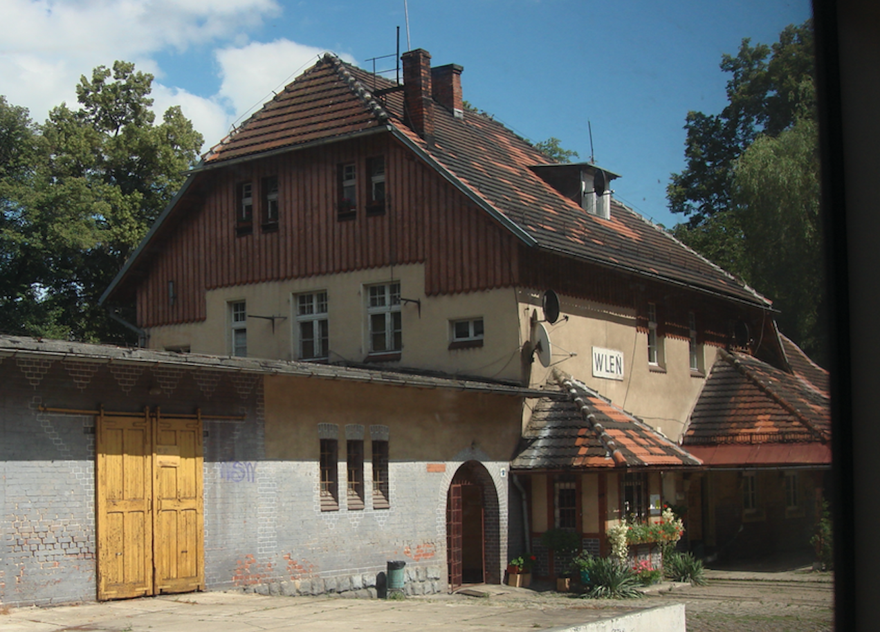
After leaving the tunnel, the trail is already within the boundaries of the town of Wleń. The Wleń station is 18.00 km long and is located at an altitude of 229 m above sea level. The railway station is located at Lipowa Street.
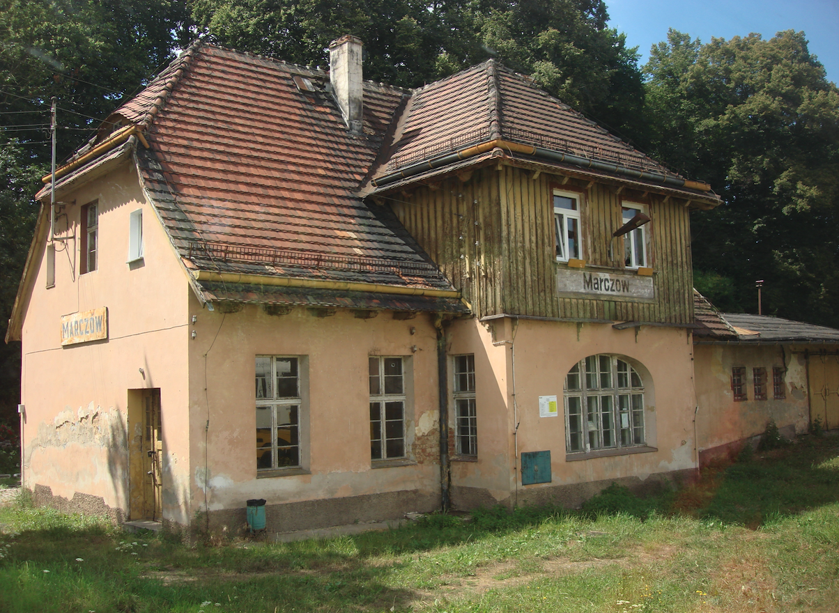
Next, the route meanders along the left bank of the Bóbr River valley and reaches the town of Marczów. The passenger stop is at 22.93 km of the route, 223 m above sea level.
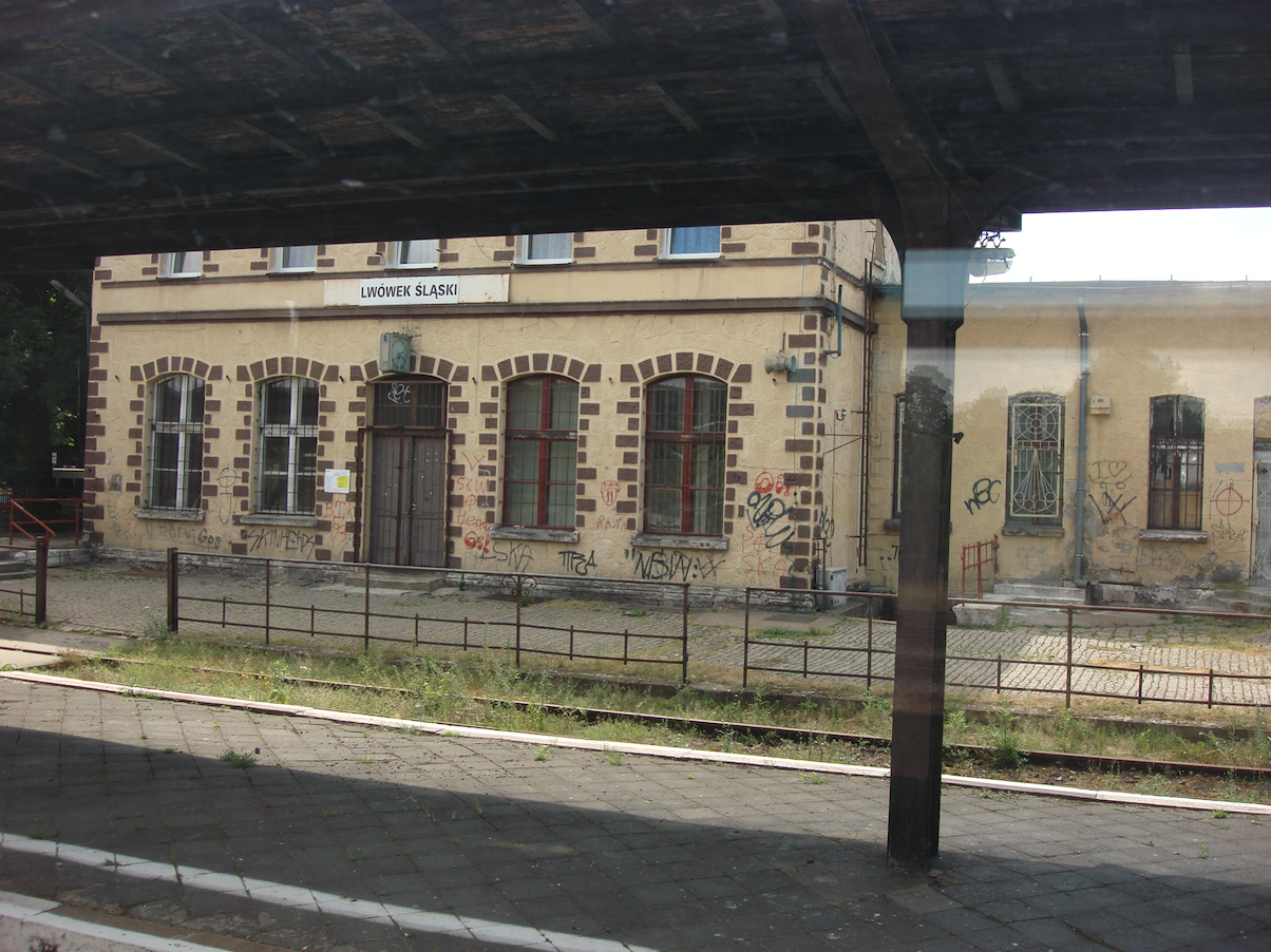
Then there is the Dębowy Gaj passenger stop; 26.63 km, at an altitude of 217 m above sea level. The station building in Dębowy Gaj burned down in the 1960s. The station was not rebuilt, only a shelter was built. Lwówek Śląski is the last station on the route that interests us. The station is on 32.63 km of the route and lies at an altitude of 211 m above sea level. Here is also the railway line No. 284 Legnica - Pobiedna. The station was launched in 1885. Passenger traffic was suspended in December 2016. The former station building has been adapted for other purposes and is partially inhabited. The station has two platforms that are two-edged. The platforms are covered. The underpass is open. The depot was used for other purposes. Water tower in good condition but not used.
Written by Karol Placha Hetman