Częstochowa 2018-12-10
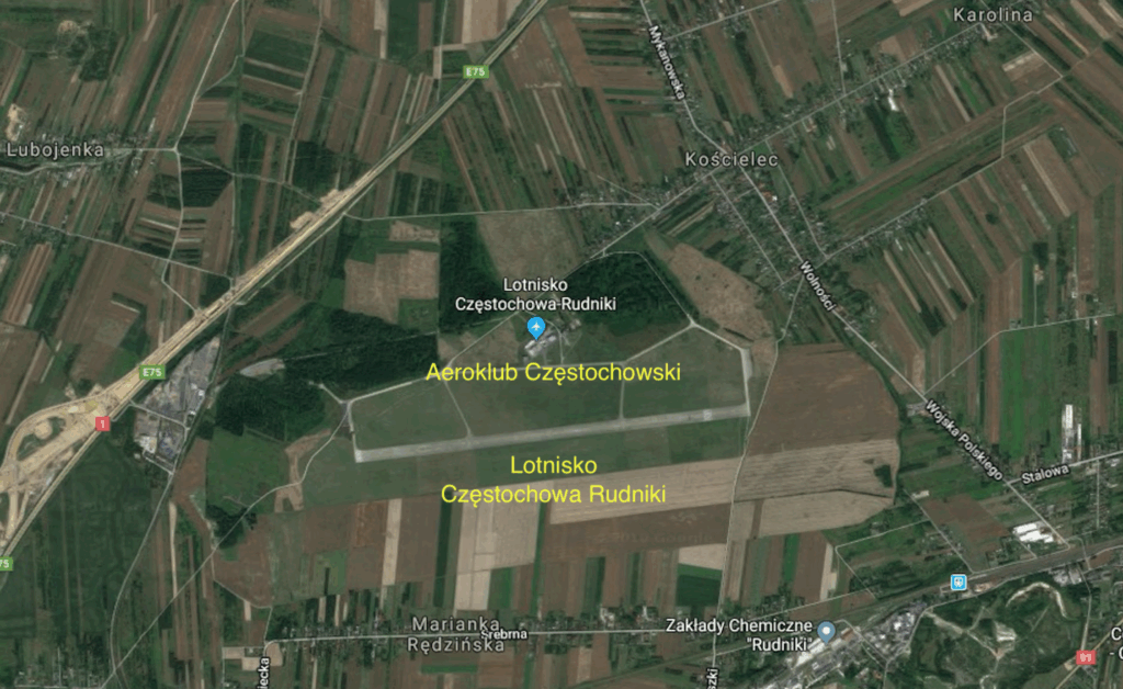
Częstochowa Rudniki Airport.
Geographic coordinates: 50.884N 19.203E. Elevation: 262 m (860 ft). Częstochowa Aeroclub, Rudniki Airport, 101 Jana Pawła II Street, 42-240 Kościelec.

The History of Częstochowa-Rudniki Airport.
After the German invasion of Poland in October 1939, part of Poland was incorporated into the Reichstag, and part of it was established as the General Government, which was to function until the complete annihilation of the Polish nation. The Germans began building new military facilities on their own land, including airports. One of these was located near Częstochowa. Construction of the airport in Rudniki near Częstochowa began in 1940. Prisoners of war and forced laborers were used in the construction. It is worth mentioning that Mierzęcice-Pyrzowice Airport was also built at the same time. However, that airport was significantly larger than the one near Częstochowa.
A hard runway measuring 1,000 m x 30 m was laid out in Rudniki and opened for use in 1942. Hangars, barracks, and technical facilities were constructed. A railway siding was built from the Częstochowa–Chorzew Siemkowice railway line (currently No. 146). In November 1942, Luftkriegschule IX was established in Rudniki, followed by another, the Segelfliegerschule der Luftwaffe Tschenstochau. Future pilots were trained here in glider courses. In January 1945, the airport played a significant role in air warfare. Several Soviet fighter and ground attack regiments were stationed here.
The date when the Soviets handed over the airport to the Polish Army is unknown. It is known that the Polish Army operated the airport from at least 1953. Around 1955, Rudniki Airport was expanded. The runway was extended to 2,000 meters and widened to 60 meters. New taxiways were constructed. A 120m x 50m Aircraft Parking Area was constructed along the eastern taxiway (connector). Because the airport was considered a reserve (training) area, no support facilities such as brick barracks, workshops, or warehouses were built. Tents, field kitchens, portable bathhouses, etc., were used as staff facilities.
In 1953, the Polish Army classified the airport as a reserve for the 39th Fighter Regiment stationed in Mierzęcice. The 53rd Fighter-Attack Regiment from Mirosławiec stationed PZL Lim-2 aircraft here periodically. Later, Lim-6 bis aircraft landed here. The airport was also used by the 6th Fighter-Attack Regiment and the 51st Fighter-Attack Regiment, both based in Piła. After 1968, the airport was periodically used by the 10th Fighter Regiment from Łask. MiG-21 aircraft from this Regiment were based here in the 1970s and 1980s. The Polish Army abandoned Rudniki Airport in the early 1990s. Military aircraft rarely landed here, and no combat aircraft landed here. At the beginning of the 1950s, the Częstochowa Aeroclub was established. However, the first parachutists, gliders, and light aircraft pilots arrived in 1957.
Attempts were made to incorporate Rudniki Airport into the network of domestic airports operated by LOT Polish Airlines. This was successful in the 1983 season. This was a significant move by the communists, who, after the suspension of martial law, offered pilgrims traveling to Jasna Góra air travel. During this time, Saint John Paul II the Great visited Poland. Antonov An-24 aircraft operated the Warsaw-Częstochowa and Gdańsk-Częstochowa routes. The route was not popular, and seat occupancy was low. Generally, the poor could not afford such luxury. A ticket cost nearly 1,000 złoty, while a worker at the cement plant in Rudniki earned 4,000-5,000 złoty. LOT Polish Airlines also operated several flights between Częstochowa and Koszalin. In addition, the communists explained that commercial flights were launched because Mierzęcice-Pyrzowice Airport was undergoing renovations. However, in such situations, aircraft were redirected to Balice Airport near Kraków. Rudniki Airport lacked any technical support for servicing commercial aircraft. This had to be built. In the 1984 season, connections were not restored.
In the 1990s and until 2003, PZL An-2 aircraft were periodically based here, used for parachute training. The airport was operated by a platoon-sized military unit. In addition to operating the aircraft and the airport, soldiers performed guard duties.
In 2001, the Polish Army transferred the airport to the Military Property Agency. The airport was put up for sale, retaining its aviation character. Since 2004, the airport has been privately owned.
From 2007 to 2017, the airport was listed in the Civil Aviation Authority’s register of airfields under item 24. In 2017, the airport was entered into the Civil Airport Register as a public-use airport not subject to certification. This means that aircraft whose flight does not require air traffic control supervision at the airport can land and take off at the airport. The airport is approved for operations by: airplanes, helicopters, gyroplanes, gliders, paragliders, powered paragliders, powered hang gliders, and parachutes – in accordance with VFR regulations, day and night, for aircraft with a gross take-off weight (MTOW) up to 5,700 kg. The airfield is open year-round, day and night. Arrivals should be coordinated with the airport manager.
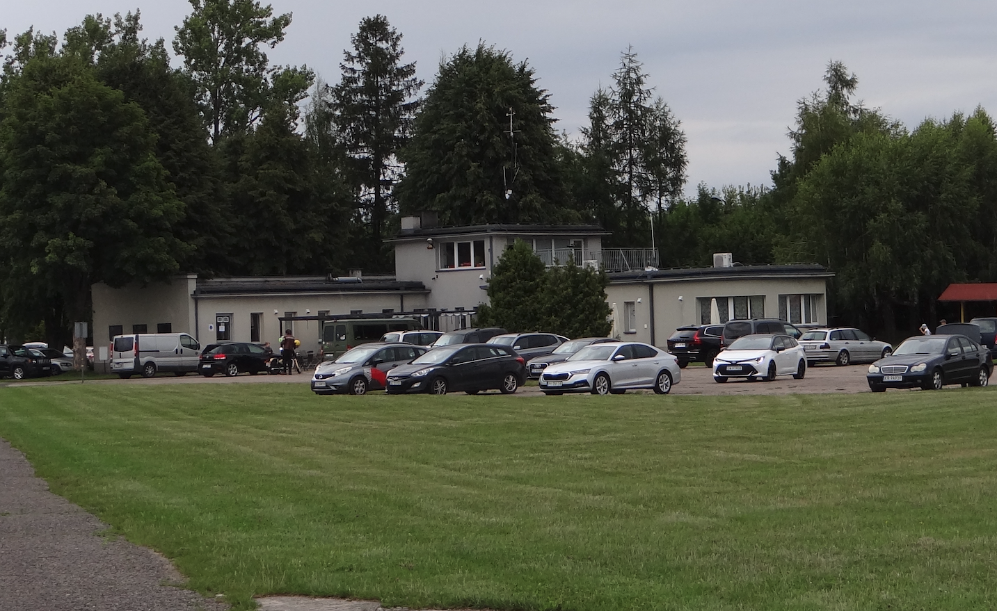
The airport has former military infrastructure: hard and dirt runways, taxiways, hangars, warehouses, a fuel depot, an air traffic control tower, and a flying club building with a café. There is a dedicated parachute landing area. There is electricity from its own transformer substation and a railway siding, largely demolished.
Incidentally, the cost of converting it to a public-use airport, not subject to certification, is approximately 1 million złoty. One of the benefits of such a conversion is the right to approach aircraft using the GNSS satellite navigation system. This allows aircraft arriving from abroad to land at the airport.
The last major tragedy, which occurred on July 5, 2014, was the crash of a Piper PA-31 aircraft near Topolowo, in which 11 people died and one was seriously injured.
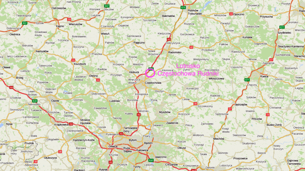
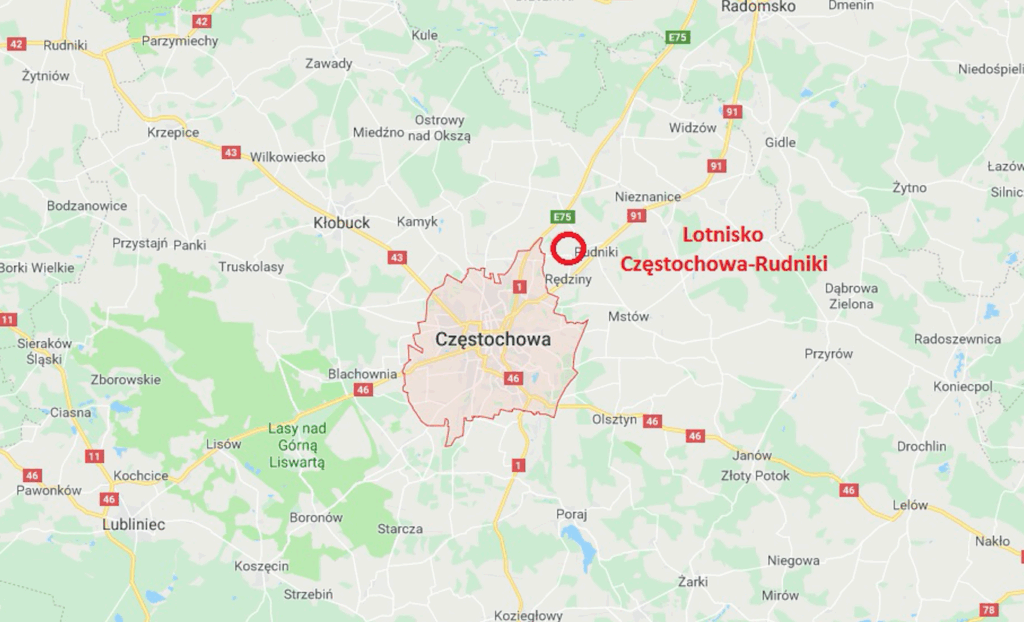
Development plans for the airport are at a local level, due to the Pyrzowice Airport being located 65 km away.
Near Rudniki Airport, in Kościelec, at the intersection of National Road No. 1 and Mykanowska Street, is the “Samolot” inn. Its main attraction is the “Odlot” restaurant, located inside a commercial Ilyushin Il-18 turboprop aircraft. The aircraft was operated by LOT Polish Airlines with registration marks SP-LSD. The Il-18 W aircraft, registration number 184007102, SP-LSD, bore the proper name “Tobruk.” The aircraft was delivered to LOT Polish Airlines as a new aircraft, built in March 1964. Delivered to LOT Polish Airlines in April 1964. During its service, it was repainted in the former LOT Polish Airlines livery for filming purposes. It was retired in January 1991. After a few years, it was purchased by a private individual.
Another LOT Polish Airlines Ilyushin Il-18 SP-LSH aircraft also operates as a restaurant in Zbytków on National Road No. 81, near Jastrzębia Góra.
Częstochowa Rudniki Airport.
The airport is located near National Road No. 1 (E-75) Cieszyn-Gdańsk, known as “Gierkówka.” Currently (2018), a Częstochowa bypass junction is being built near the airport. The city center is 10 km away.
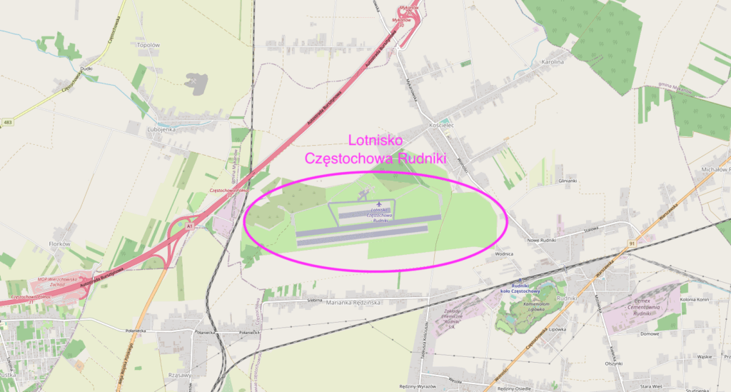
The airport is a sports airport. It is managed by the Częstochowa Aeroclub and owned by a private entity. IATA code – CZW. ICAO code – EPRU. Geographic coordinates: 50°53′10.08″N 19°12′08.90″E. Altitude: 262 m above sea level (860 ft). The landing field has one hard concrete runway in the 08/26 direction, measuring 2,000 m x 60 m. The threshold of the main runway, DS1, has been moved 200 m to the west. Parallel to this are dirt and grass runways. Typically, these are designated as Runway 2, measuring 720 x 240 m, and Runway 3, measuring 1,800 x 140 m. Runways 2 and 3 are marked with white delimiters no more than every 100 m. Each delimiter has a minimum size of 3 m x 1 m.
Radio communication – Rudniki Radio – 122.800 MHz. Aeroklub tel.: +48 783 995 277, +48 34 32 79 755. The airport is suitable for aircraft with a take-off weight of up to 5,700 kg. The take-off area is adequately lit and ready to accommodate airplanes and helicopters using the GNSS satellite navigation system.
Written by Karol Placha Hetman