Kraków 2013-03-14
Outline of the History of Navigation. The Beginnings. 1919

In the initial period of aviation development, the problem of navigation was marginal. This was due to the short distances covered by the first airplanes. The first serious applications of air navigation occurred with the development of airships. And when it seemed that this was the right direction, the shortcomings of airships were revealed. First of all, their flammability related to the use of hydrogen, a gas lighter than air, filling the balloon. An attempt to save the situation by using helium failed due to the high cost of its production. The second problem turned out to be the great susceptibility of airships to weather changes, and especially variable, even unpredictable wind, leading to dangerous and difficult to control situations.
The outbreak of the Great World War did not significantly develop air navigation. Flights over longer distances had to wait.
Before we discuss the introduction to air navigation, we must point out several factors that stimulated the development of passenger and transport aircraft. Let us remember that the 19th century was the century of electricity and steam. Steam led to the unexpected development of railways, which by the end of the 19th century covered almost all of Europe with their network. Railways enabled cheap transport for millions of people. Travel by train was convenient, fast and punctual. On the other hand, increasingly larger and more luxurious ocean ships sailed the seas and oceans. Both types of communication, at the beginning of the 20th century, were very well developed. The only thing that could threaten them was aviation, which combined travel over land and water, which neither railways nor ships could do.
Additionally, in aviation itself there was a fight between; controlled balloons (airships), airplanes and gyroplanes. Few people remember the latter, because they ended at the beginning of the 40s of the 20th century, as helicopters.
The Great World War claimed over 10 million victims. All nations lost a lot. States showed great distrust and suspicion towards each other. Despite everything, it seemed that the peace compromise that was reached would last a long time. There were also nations that were happy with the new order in Europe, because they had regained independence. The Republic of Poland was one of these countries. After 123 years, Poland reappeared on the map as a sovereign state.
The role of France, the UK and the USA in the development of long-distance flights.
Only three countries achieved significant success in the development of air navigation. These were France, the United Kingdom and the United States of America. The remaining countries based their achievements on their achievements. This arrangement did not result only from the development of technology and civilization, but above all from the overriding goals that guided these countries. In the case of France and Great Britain, it was the desire to ensure communication with the dominions. In the case of the USA, continental communication and communication with Europe and the islands in the Pacific Ocean.
The first mentioned France, right after the Great World War, made the greatest contribution to the reunification of bloodied Europe and building a common future. However, this was very difficult, due to the aggressive attitude of the Germanic peoples and what was created on the territories of former Russia. Therefore, only the countries of Central Europe, the Balkans, the Iberian Peninsula, the Benelux countries and, of course, Great Britain joined the cooperation. France was the first to establish air contacts with Great Britain. The world’s first airline was established on the Paris-London route. Internally, however, it was the first to launch the Paris-Marseille connection. Of course, France was far-sighted. Their goal was West Africa and South America.
Great Britain had even bigger plans, but it was not interested in Europe. From the very beginning, the UK focused on East Africa, the Middle East, India, the Indochina Peninsula and Australia. This was due to completely different priorities. Their economic power was largely dependent on what was happening in the colonies
The Americans approached the problem of air transport in a different way. The vast internal area required good and even development. The main direction was the east-west line, from New York, through Chicago to Los Angeles. At the same time, the East Coast was more populated and economically higher. The external directions of the USA were the route through the Atlantic Ocean to Europe (UK and France) and the Pacific Ocean. It should also be remembered that the Great World War did not directly affect the territory of the USA and Canada. What is more, both countries became significantly richer from the war in Europe. The Americans sold weapons to the Allies and then supplied them with consumer goods. Many Americans actively participated in the fighting in Europe.
The role of the Republic of Poland in the development of long-distance flights.
Contrary to current opinion and in the current times of falsification of history, the role of Poland and Polish pilots was significant. In the interwar period, we achieved significant successes in the international arena; in balloon sports, gliding and aircraft sports and competitions. We have achieved a world-class level in designing, building and producing many modern aircraft. We were the first country in the world to have all metal fighter aircraft in the Air Force. We also wrote some great stories in long-distance flights. This proves that we have mastered the basics of navigation on long routes. Polish postal and passenger transport companies have been developing their network of connections every year. After their consolidation, from 2nd January 1929, as the company Polish Airlines LOT, they had the second largest network of connections (after Air France). LOT Polish Airlines quickly went beyond Europe, with real plans for flights to South America and the USA. Many Polish pilots from LOT Polish Airlines exceeded 250,000 km, 500,000 km and also 1,000,000 km of air kilometres during this time.
Air navigation. 1919
In the new reality, hundreds of useless military aircraft and many trained pilots remained as a legacy of war operations. It was necessary to consider how to use this potential sensibly. Organized shows, races and sightseeing flights aroused great interest. But they only partially solved the problem. The development of tourist aviation encountered huge problems due to other urgent needs. The first aviation associations and organizations were established, intended to attract a new generation of young people to aviation and anti-gas defense.
The first air connections for the transport of mail and at the same time people (not yet treated as commercial passengers) began to be organized spontaneously. However, the available aircraft were not very well prepared for this type of role. They had to be rebuilt.
What did the first pilots have for navigation on longer routes? There was not much of it. First of all, there were maps. Over land, military maps were used, the availability of which was large after the Great World War. Pilots made their own corrections on the maps, in the form of characteristic landmarks. These were usually church and town hall towers. Railway stations. Railway lines, rivers, and above all bridges. Especially those with steel, truss structures or high stone ones (with characteristic arches), which stood out perfectly against the background of the terrain. Also characteristic were solitary buildings; windmills (mills), monasteries, castles or their ruins, factory chimneys, mine shaft towers, oil wells. Less often solitary trees or towers for observing the threat of fire. Finally, the terrain itself and its characteristic transitions. For example; the ending area of the forest and the beginning of the hills. Or the end of cultivated fields and the beginning of wetlands, wastelands. Characteristic hills and cliffs.
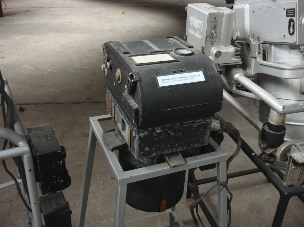
Aerial photographs taken during warfare were often used. These photographs were used to identify characteristic points on the planned flight route.
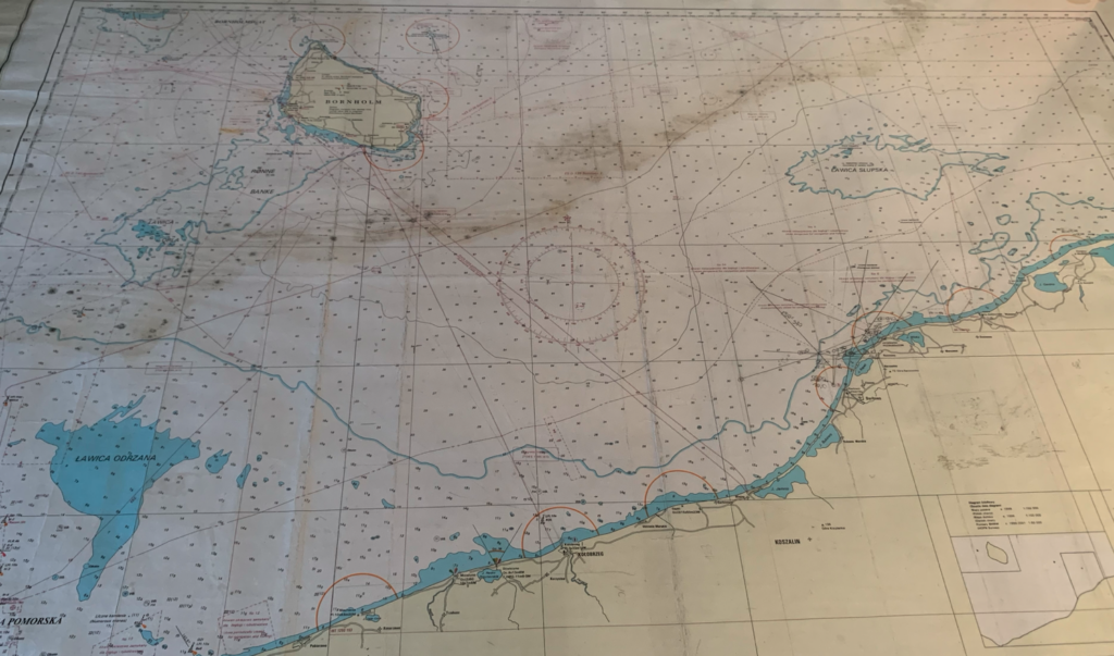
Nautical maps were used over open water areas; at that time, they were much more accurate than land maps. Although they contained a lot of information that was unnecessary for pilots, they were perfect for setting and maintaining a course. These maps also included marked lighthouses, which spontaneously became excellent landmarks for pilots.
Aircraft course.
The course of an aircraft was the first thing that pilots had to deal with. The course of an aircraft had to be set before the flight and, if necessary, places where this course had to be changed had to be designated. In another chapter, we mentioned the magnetism of the earth, declination and inclination. As it turns out, these phenomena have a major impact on determining the course of an aircraft. Due to the characteristics of the earth’s magnetic field, when using a magnetic compass on board an aircraft, we deal with three types of course.
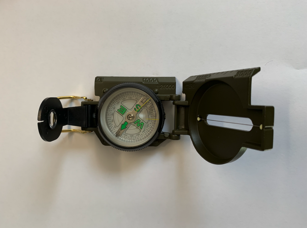
Compass course. This is the direction of the aircraft indicated by the on-board compass.
Geographic course. The direction of the aircraft measured to the right of the geographic meridian, expressed in degrees. It can be calculated by adding the deviation value to the course of the on-board compass (we will then obtain the magnetic course), and then adding the declination value to the magnetic course. The deviation of the magnetic compass is the errors in its indications. A broader discussion of the on-board compass is in another chapter – On-board instruments.
Magnetic course. This is the direction of the aircraft measured to the right of the magnetic meridian, expressed in degrees. It can be calculated by adding the declination value to the compass course.
There is also the so-called combat course, i.e. the direction of the aircraft’s flight during combat flight when arriving at and approaching the target.
In that case; the aircraft’s course is the angle between the selected reference direction (direction of the geographic meridian, magnetic meridian) and the longitudinal axis of the aircraft. But it must be remembered that the aircraft flies perfectly on course only in calm weather, which practically does not occur. And this is another problem that pilots had to deal with.
The declination mentioned many times has different values and signs in different points on the globe. Additionally, declination is subject to periodic fluctuations. That is why declination began to be marked on topographic maps. Lines connecting points with the same declination, in size and sign, are called isogons. Isogons are marked on maps every 1 degree as red or purple dashed lines. In Poland, magnetic declination fluctuates within the range of approximately plus/minus 2 degrees.
Written by Karol Placha Hetman

