Słupsk 2013-04-06
Former military airport in Słupsk.
Data from T-T at the Słupsk Airport in 2010.
The airport was entered in all statements and lists of airports. It had an IATA code – TSO, it has an ICAO code – EPSK. It was entered in the Polish register as the Słupsk-Pomorze Airport. It was treated as an airport of Sanitary Aviation. The airport has geographic coordinates; latitude 54 degrees 28 minutes 43 seconds N, longitude 17 degrees 06 minutes 23 seconds E. Else 54.478N 17.104E. Elevation 66 m above sea level. The airport from the Baltic Sea is only 17 km away. The center of Słupsk is 5 km away. The airport is located on the National Road No. 6 Szczecin – Słupsk – Gdańsk.
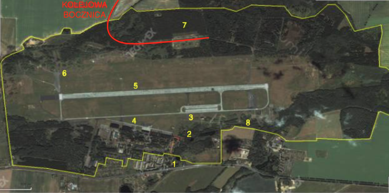
Description of the photo: 1 Main entrance gate and the officers’ estate. 2 Building from WKL. 3 CPPS. 4 Aircraft hangar complex. 5 RWY. 6 and 8 Center of planes zone. 7 MPS.
In 2010, most of the facilities and grounds of the former airport were closed and guarded by a security company.
Written by Karol Placha Hetman

